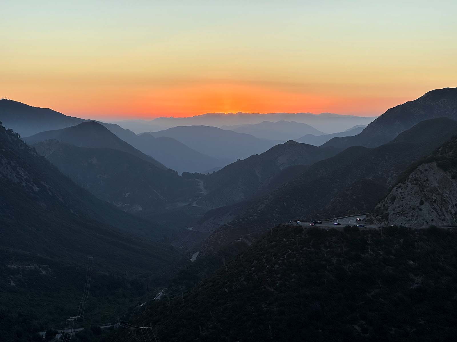
Angeles Crest Highway Road Guide
Jane Strong and Tom Chester made this amazing road guide for the Angeles Crest Highway (SR-2) (last updated 2005). It's so useful it's in the header of this site (with their permission). Click the links in the road guide, they direct to Tom Chester's site and have lots of great information.
And if you think this is useful you should really check out the Angeles Crest Scenic Byway Roadside Inventory (word document). Originally a printed guide written by Gerald Reponen in 1989, it was edited/updated by Michael Smith in 2019. Both Reponen and Smith worked for the USDA Forest Service. I often reference this document; we are lucky to have it.
| Distance From I-210 (miles) | Time From I-210 (HR:MIN) | Mile Marker (miles) | Location and Parking Info | Restroom |
|---|---|---|---|---|
| 0.00 | 0:01 | LA 24.54 | Immediately north of I-210 | no |
| 0.96 | 0:03 | LA 25.50 | Cross Foothill Fault near Gould Canyon bridge | no |
| 1.93 | 0:03 | LA 26.47 | Parking for Gould Mesa Service Road at transformers, on right | no |
| 2.16 | 0:04 | LA 26.70 | CalTrans gate | no |
| 2.31 | 0:04 | LA 26.85 | 2000 feet elevation | no |
| 2.46 | 0:04 | LA 27.00 | Enter ANF | no |
| 2.68 | 0:04 | LA 27.22 | First of 3 large turnouts, on right | no |
| 2.79 | 0:05 | LA 27.33 | Second of 3 large turnouts, view of Arroyo Seco and Pasadena, on right | no |
| 3.19 | 0:06 | LA 27.73 | Angeles Crest Forest Station, on left | no |
| 3.86 | 0:06 | LA 28.40 | Third of 3 large turnouts, now blocked, on right | no |
| 4.04 | 0:08 | LA 28.58 | Slide Canyon Bridge | no |
| 5.05 | 0:08 | LA 29.59 | Woodwardia Bridge | no |
| 5.48 | 0:09 | LA 30.02 | Parking for Upper Dark Canyon Trail, on left | |
| 5.94 | 0:09 | LA 30.48 | Lower Dark Canyon trailhead (CCC Ridge), on right | no |
| 6.11 | 0:10 | LA 30.65 | Parking for Fire Road 2N80, on left | |
| 6.15 | 0:12 | LA 30.69 | 3000 feet elevation | no |
| 7.91 | 0:12 | LA 32.45 | Dewey's Pit [a landslide area] | no |
| 8.01 | 0:12 | LA 32.55 | Burton's curve | no |
| 8.06 | 0:14 | LA 32.60 | Georges Gap, Clear Creek Vista, on left | |
| 9.26 | 0:15 | LA 33.80 | Junction with Angeles Forest Highway, Clear Creek (Ranger) Station, on left; Clear Creek Information Station, on right | no |
| 9.60 | 0:15 | LA 34.14 | Switzer Picnic Area, on right | yes |
| 9.96 | 0:18 | LA 34.50 | Colby Canyon Trailhead, on left | no |
| 11.63 | 0:20 | LA 36.17 | Beginning of Ladybug Curve; 4000 feet elevation | no |
| 13.06 | 0:21 | LA 37.60 | Large turnout, view of upper Arroyo Seco | |
| 13.84 | 0:22 | LA 38.38 | Red Box, Mt. Wilson Road, on right | yes |
| 13.96 | 0:23 | LA 38.50 | CalTrans gate and sand tower | no |
| 15.07 | 0:25 | LA 39.61 | Lone Pine Ridge | no |
| 15.87 | 0:25 | LA 40.41 | Turnout; view of West Fork and Mt. Wilson | |
| 16.08 | 0:26 | LA 40.62 | "Trees for Color" | no |
| 17.06 | 0:28 | LA 41.60 | Badger Gap | no |
| 18.06 | 0:29 | LA 42.60 | Junction Barley Flats Road, Upper Big Tujunga Road | |
| 18.46 | 0:29 | LA 43.00 | Shortcut Picnic Area, sans tables(!), on left | yes |
| 18.76 | 0:30 | LA 43.30 | Shortcut Saddle, parking mostly on right | no |
| 19.57 | 0:33 | LA 44.11 | 5000 feet elevation | no |
| 20.71 | 0:32 | LA 45.25 | Bobcat Saddle | no |
| 21.46 | 0:36 | LA 46.00 | Windy Gap - View of Big 4 peaks (Baldy, San Gorgonio, San Jacinto, Santiago Peak), San Gabriel Wilderness | |
| 22.96 | 0:39 | LA 47.50 | Charlton Flats Picnic Area, on left | yes |
| 25.16 | 0:39 | LA 49.70 | Chilao Campground turnoff, on left | yes |
| 25.36 | 0:40 | LA 49.90 | View of Devil's Canyon | |
| 25.96 | 0:40 | LA 50.50 | Devils Canyon trailhead on right, parking on left | no |
| 26.06 | 0:41 | LA 50.60 | Chilao Visitor Center turnoff, on left | yes |
| 26.39 | 0:44 | LA 50.93 | Newcomb's Ranch, on left | |
| 28.26 | 0:46 | LA 52.80 | Three Points Junction, Three Points Trailhead, Santa Clara Divide Road, signed only as "To Horse Flats" and perhaps "To Organizational Camps", on left | yes |
| 29.48 | 0:46 | LA 54.02 | PCT Crossing, parking on right | |
| 29.68 | 0:47 | LA 54.22 | 6000 feet elevation | no |
| 30.47 | 0:48 | LA 55.01 | Winston Springs | no |
| 30.90 | 0:48 | LA 55.44 | Avalanche Canyon | no |
| 31.12 | 0:49 | LA 55.66 | Cloudburst Canyon | no |
| 31.55 | 0:50 | LA 56.09 | Panorama Curve | no |
| 32.16 | 0:50 | LA 56.70 | Motorcycle Curve | no |
| 32.43 | 0:50 | LA 56.97 | PCT Crossing, parking on left | |
| 32.56 | 0:51 | LA 57.10 | Cloudburst Summit | no |
| 32.96 | 0:51 | LA 57.50 | Mt. Waterman Ski Area | no |
| 33.16 | 0:52 | LA 57.70 | Roadside turnout, Buckhorn Peak trailhead, on left | no |
| 33.46 | 0:52 | LA 58.00 | Buckhorn trailhead for Mt. Waterman hike on right, parking on left | no |
| 33.71 | 0:54 | LA 58.25 | Entrance road to Buckhorn Campground, on left | yes |
| 34.81 | 0:56 | LA 59.35 | Snowcrest Ski Area, formerly Kratka Ridge | no |
| 36.13 | 0:57 | LA 60.67 | Vista Picnic Area, on right | |
| 36.55 | 0:57 | LA 61.09 | Cedar Springs | no |
| 37.06 | 0:58 | LA 61.60 | Eagle's Roost Picnic Area, PCT parking on right, CalTrans sand shed | yes |
| 37.45 | 0:59 | LA 61.99 | Williamson Rock, parking on left | no |
| 37.86 | 0:59 | LA 62.40 | Mt. Williamson trailhead, at an unnamed saddle, parking area, on left | no |
| 38.26 | 1:00 | LA 62.80 | Beginning of two tunnels | no |
| 38.96 | 1:01 | LA 63.50 | Jarvi Memorial Vista, on right | yes |
| 39.56 | 1:02 | LA 64.10 | Islip Saddle, PCT parking lot on left, closed SR-39 on right | yes |
| 40.01 | 1:03 | LA 64.55 | Cortelyou Spring | no |
| 40.96 | 1:04 | LA 65.50 | Gated Fire Road on right, (former Pine Hollow Picnic Area on left) | no |
| 41.59 | 1:05 | LA 66.13 | Elly Bar | no |
| 41.84 | 1:07 | LA 66.38 | Little Jimmys | no |
| 41.86 | 1:07 | LA 66.40 | White Fir Spring | no |
| 43.06 | 1:07 | LA 67.60 | Best snow-melt gully for wildflowers, on right; desert view to north | no |
| 43.53 | 1:08 | LA 68.07 | 200 | no |
| 43.73 | 1:08 | LA 68.27 | 212 | no |
| 44.10 | 1:09 | LA 68.64 | Matthew Ridge | no |
| 44.65 | 1:10 | LA 69.19 | Strawberry Guard Rail | no |
| 45.06 | 1:11 | LA 69.60 | Dawson Saddle, parking on left | no |
| 46.06 | 1:12 | LA 70.60 | Dorr Canyon; desert views, geology | no |
| 46.46 | 1:13 | LA 71.00 | Whitethorn | no |
| 47.03 | 1:13 | LA 71.57 | Broken Wall | no |
| 47.44 | 1:14 | LA 71.98 | Snow Canyon | no |
| 47.79 | 1:15 | LA 72.33 | Jackhammer Tree | no |
| 48.18 | 1:15 | LA 72.72 | Lone Wall | no |
| 48.28 | 1:16 | LA 72.82 | Mojave Desert Vista | no |
| 48.82 | 1:16 | LA 73.36 | 7000 feet elevation | no |
| 49.40 | 1:18 | LA 73.94 | Icy Springs | no |
| 50.26 | 1:20 | LA 74.80 | Vincent Gap, PCT parking, on right | yes |
| 51.57 | 1:22 | LA 76.11 | Blue Cut | no |
| 52.76 | 1:23 | LA 77.30 | Grassy Hollow Visitor Center, on left | yes |
| 53.56 | 1:26 | LA 78.10 | Blue Ridge Summit, Lightning Ridge and PCT parking on left, Blue Ridge Road, Inspiration Point Parking on right | yes |
| 55.36 | 1:27 | LA 79.90 | Big Pines, on left | yes |
| 56.26 | 1:29 | LA 80.80 | Mountain High East Ski Resort, on right | no |
| 57.73 | 1:30 | LA 82.27 SB 00.00 | L.A. / S.B. County Line Enter Wrightwood | no |
| 58.03 | 1:30 | SB 00.30 | S curve | no |
| 58.48 | 1:31 | SB 00.75 | 6000 feet elevation | no |
| 59.06 | 1:32 | SB 01.30 | Pine Road, Wrightwood, on right | no |
| 59.66 | 1:33 | SB 01.70 | Lone Pine Road, Wrightwood, on right | no |
| 60.26 | 1:34 | SB 02.30 | Sheep Creek Road | no |
| 60.46 | 1:35 | SB 02.50 | Leave Wrightwood | no |
| 61.29 | 1:36 | SB 03.33 | Stock Pile | no |
| 62.16 | 1:37 | SB 04.20 | Desert Front Road | no |
| 62.46 | 1:37 | SB 04.50 | Coor Pender | no |
| 62.81 | 1:37 | SB 04.85 | 5000 feet elevation | no |
| 62.96 | 1:39 | SB 05.00 | Leave ANF | no |
| 64.26 | 1:39 | SB 06.20 | end SR2 at SR138 | no |